Elegant International

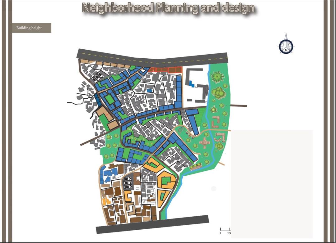

An incredibly lifelike, richly detailed, photorealistic aerial photograph of a dense urban neighborhood planned for varying building heights, set in a sprawling city. The scene is illuminated by a clear, midday sun, casting sharp shadows and creating a bright, vibrant atmosphere. Captured with a high-altitude drone, emphasizing the intricate network of streets, building footprints, and green spaces, showcasing a mix of building designs from sleek international-style residential blocks to more traditional, closely packed structures. The photograph highlights the distinct color-coding used to represent building heights and property types, with areas of blue, orange, and varying shades of brown denoting different zones. Lush green parks and tree-lined avenues add splashes of natural color amidst the urban fabric, with a winding waterway carving through the landscape. The composition provides an unobstructed view of the urban layout, allowing for detailed observation of the planning and design elements. The depth of field is sharp, rendering every building, pathway, and green patch with crisp clarity, giving the impression of examining a meticulously crafted architectural model.